Efficiency in the field: How Romarheim saves working hours and keeps documentation up to date with Ditio and Infrakit

Customer Story · Romarheim AS
Key takeaways
- Romarheim AS uses Ditio and Infrakit together to connect planned and completed work in one workflow.
- Ditio documents the work in the field – photos, checklists and HSEQ – while Infrakit ties the documentation to an exact position in the map and model.
- For project engineer Kasper Håland, the integration means several working hours saved per week, less searching and lower risk of errors and rework.
Romarheim AS has, over time, adopted digital tools to make the execution of large and complex construction projects more efficient. Infrakit and Ditio are two of the systems used in daily project work. For Romarheim, the combination of the two systems has become a prerequisite for managing large, complex infrastructure projects — with concrete tools for documentation, accuracy and efficiency in the field.
One of the clearest examples is Sotrasambandet, one of Western Norway’s largest infrastructure projects. Through the joint venture company Romarheim & Rivenes AS, Romarheim has for several years been involved in groundworks, the traffic interchange and infrastructure around Storavatnet in the municipality of Bergen. In October 2025 the assignment was expanded with a contract worth NOK 450 million — the largest single contract in Romarheim’s history.
A connected workflow for the entire project organisation
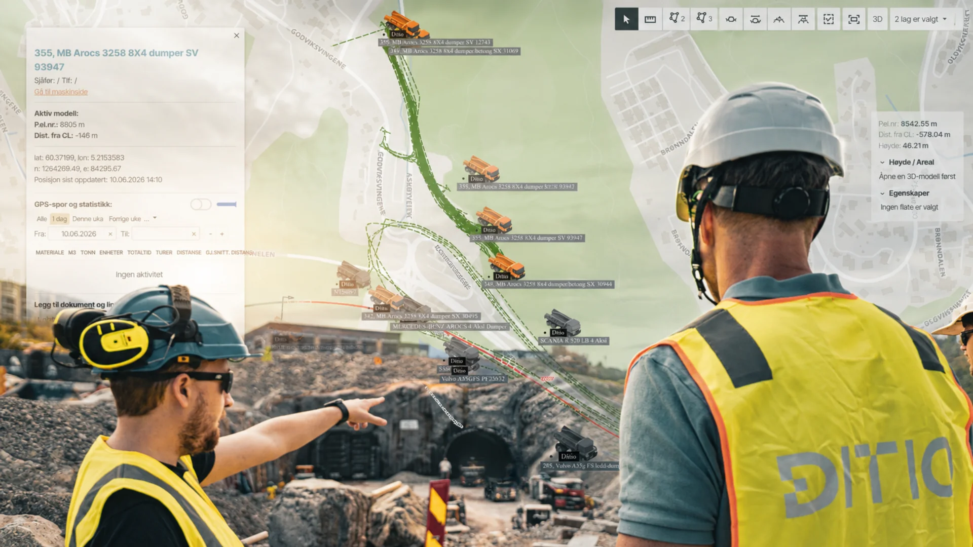
For Romarheim, using Infrakit and Ditio is about more than just machine control and surveying. Infrakit contributes models, surveys, machine control, machine positions and drone imagery. Ditio adds checklists, information descriptions and photo documentation. Together, the systems make relevant project information available both to those carrying out the work on site and to those following up the project from the office.
Where data previously had to be coordinated manually between systems and people, project participants can now retrieve the information and gain insight themselves. This saves time and reduces the risk of misunderstandings between links in the project organisation. Through the integration, project information from the two systems is connected more closely — from models, surveys, machine production and drone imagery to checklists, information descriptions and photo documentation.
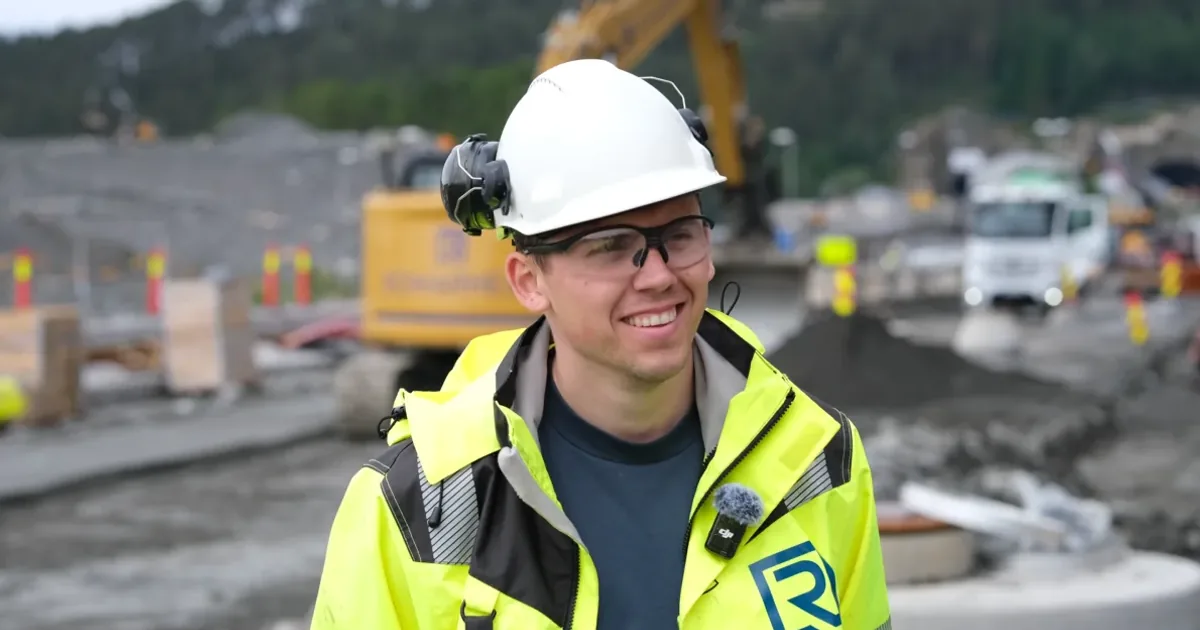
”Infrakit and Ditio meet different needs in the project, but it is when the information is connected that we get the greatest value. That gives us a better link between what is planned and what is actually carried out on site.”
— Kasper Håland, project engineer at Romarheim AS
From specialist tool to a shared language on site
The information generated by Infrakit and Ditio is not reserved for surveyors or project managers either. With the help of visualisations, everyone involved in a project can see the details without needing specific technical expertise. Everyone on the project can retrieve up-to-date models, logs and surveyed data, and see what is to be done where.
When everyone sees the same information, it reduces the risk of work being carried out in the wrong place, work based on outdated drawings, or measures that are not coordinated with other disciplines. It reduces the risk of errors and rework, and contributes to better progress in the project.
Ditio – documentation from the field
Infrakit gives the project team the up-to-date map- and model-based project foundation, with models, machine and survey data and geographic overview, while Ditio is used for the ongoing operational documentation from the work out in the field. Here, images, checklists, HSEQ documentation and information about completed work are recorded. Ditio is also used to follow up productivity and emissions in the projects.
The information is recorded while the work is ongoing and linked to the correct project and activity. This allows Romarheim to follow up the project more closely, find the documentation where it belongs and see faster what has been done, what remains and what needs follow-up.
Through the link between Ditio and Infrakit, documentation from the field is tied to the correct geographic location and seen in the context of the project foundation. Infrakit shows what is to be done and where, while Ditio documents what is actually carried out. Together, the systems give Romarheim a clearer link between planned and completed work. It is in the interplay between the two systems that much of the value lies.
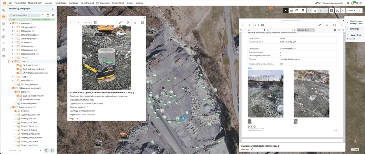
Precise documentation directly on the map
Kasper Håland, project engineer at Romarheim, is a good example of how the link between the two systems works in practice for the individual employee in the project organisation. Håland says the integration between Ditio and Infrakit has made his working day significantly more efficient, and that during a normal working week he can save several working hours thanks to the interplay between the two tools.
”For me, the integration is largely about not having to search. I can go from an area or object in Infrakit to the documentation I need in Ditio, and vice versa. That makes it easier to find out what has been done, where it has been done and which documentation belongs to it.”
— Kasper Håland, project engineer at Romarheim AS
Romarheim has many employees who at any time are carrying out construction activities that must be followed up according to checklists and documented with both images and text about what has been done. This is where Infrakit comes in with an exact position on the map for each individual object, while drone-based orthophoto and video update the map foundation in real time. With large volumes of documentation to keep track of, Håland believes accurate location makes a significant difference:
“It helps a lot when objects can be specified with an exact location.”
In daily work, the flow goes both ways. Sometimes Håland starts the work in Infrakit and continues in Ditio, other times it is the other way around. It is precisely this two-way interconnection between the systems that has eased the working day for Håland and his colleagues at Romarheim. Even though he already uses both systems actively, Håland believes the potential for further efficiency is far from exhausted. He finds that the more the systems are used, the more opportunities for efficiency and better documentation are uncovered along the way.
The interplay provides a clear documentation of all infrastructure, what has been carried out, and exactly where the objects are located on a detailed map. For a contractor as large as Romarheim, where every construction site involves many people at work, high activity and significant volumes of documentation, this provides reassurance. The documentation of completed work and the precise location details are recorded continuously. Everything happens in real time, so that everyone on the project can follow the progress of activities on the construction area.
I can almost picture the challenges in my working day if I had to do without these work tools.
— Kasper Håland, project engineer at Romarheim AS
Håland’s experiences fully match what Visa Hokkanen at Infrakit highlights as the biggest synergies of using Infrakit and Ditio together.

”The value arises when information from the field can be seen in context with the project’s map, models and other project data. The integration with Ditio makes it easier to connect planned and completed work, so that the project team gets a better basis for coordination and decisions along the way.”
— Visa Hokkanen, Chief Product Officer, Infrakit
Read also
How Ditio and Infrakit Connect Field Data with the Project Model
How the integration works to give project managers full progress control — in real time.
Less rework, closer collaboration
For a project like Sotrasambandet, with a long time horizon, many disciplines and several parties involved, good information flow is crucial. When work basis, surveying and machine control are in Infrakit, and operational documentation, HSEQ and productivity are followed in Ditio, Romarheim gets a holistic picture of the project — from planned model to actual completed work.
The integration between Infrakit and Ditio allows Romarheim to connect the project foundation with documentation from the field in one connected workflow. This reduces the need for information to be conveyed verbally or manually between links in the project organisation, and makes it easier to detect deviations while it is still possible to correct course.
”The value lies in placing the data from the field into the right project context and getting the information to flow better through the project. When the documentation in Ditio is connected with maps and models in Infrakit, it becomes easier to see the link between planned and completed work, detect deviations earlier and reduce the risk of errors and rework.”
— Pawel Syslo, Chief Product Officer, Ditio
The experiences of Kasper Håland at Romarheim AS show that the gain is not only organisational, but also for individuals in the project. Concretely, this means several working hours saved per week, up-to-date documentation and accurate location details on an ongoing basis — and a still untapped efficiency potential that Håland believes grows the more the systems are used.
What Romarheim gets by using Ditio and Infrakit together
- A clearer link between planned and completed work
- Documentation tied to the correct object and exact location
- Several working hours saved per week for the individual employee
- Deviations detected earlier — fewer errors and less rework
- A better basis for coordination and decisions along the way
Frequently asked questions about Romarheim, Ditio and Infrakit
How does Romarheim use Ditio and Infrakit together?
Infrakit gives Romarheim the map- and model-based project foundation – models, surveys, machine control and drone imagery – while Ditio handles the ongoing documentation from the field, such as photos, checklists, HSEQ and production. Through the integration, the field documentation is tied to the correct object and exact position on the map, so planned and completed work are seen in context.
What value does the integration between Ditio and Infrakit provide?
The integration provides a clearer link between planned and completed work, less manual coordination between office and site, and lower risk of errors and rework. For project engineer Kasper Håland at Romarheim, the interplay between the two tools means several working hours saved per week, because he no longer has to search for documentation across the systems.
Why is accurate location important in the documentation?
When each object gets an exact position on the map, you can find the documentation again where the work was actually carried out. With large volumes of photos, checklists and HSEQ documentation, precise location details reduce time spent searching and the risk of work being done in the wrong place or on an outdated basis.
Who benefits from the information in the project?
The information is not reserved for surveyors and project managers. With the help of visualisations, everyone involved can see the details without specific technical expertise, and retrieve up-to-date models, logs and surveyed data. When everyone sees the same situational picture, collaboration gets closer and errors fewer.
How can my company start using Ditio and Infrakit together?
To use Ditio and Infrakit together, the project needs access to both solutions. The integration connects information from Infrakit with the workflow and documentation in Ditio, so relevant project information becomes available to the entire project organisation.
Ditio helps you set up the integration. Get in touch with us, and we’ll show how Ditio and Infrakit can be used together in your project.
Want to connect the field and the model on your projects?
See how Ditio and Infrakit can be adapted to your workflow — with no obligations.
Related articles